Posts

Showing posts from June, 2021

Reflection: Day 1 - 4

Image
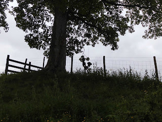
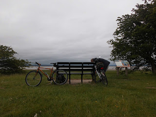
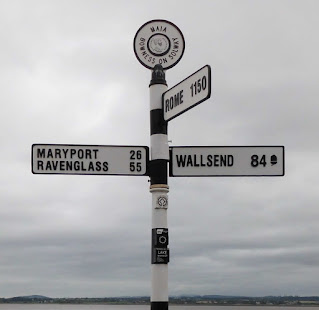
We're home again after our first outing to walk Hadrian's Wall Path.  We're both looking forward to continuing from where we left off and already have an outline of a plan for the middle section.  This, we will probably do in two parts but we'll see. One of the best things so far, is being able to accommodate changes to make the most of the circumstances in which we find ourselves.  Fortunately, we're not restricted too much on timing or timescale and intend to enjoy all of the walk rather than dash through to tick some sort of box. The highlight so far is discovering places, sights, sounds and even fragrances we would not have experienced without undertaking HWP.  The villages are beautiful and are obviously loved by their residents; Carlisle's riverside spaces and parks are lovely and the River Eden, a constant companion offers picturesque viewpoints which I could imagine 19th century, romantic painters and poets using as inspiration.  In different circumstanc

Day 4: Low Crosby Bridge to Rickerby Park

Image
An early start today.  We needed to have had breakfast (with covid restrictions the table only service was keeping the staff busy running around for everyone so breakfast could have taken a lot long than it did), checked out & loaded the car and be at the bus stop in time for the 685 bus to Warwick Bridge.  Then onward to Low Crosby Bridge by taxi.   It was great to have the short taxi ride to our start.  Paul Messenger, Warwick Bridge Taxis , was a mine of local information and an excellent contact for when we return to walk our second part of HWP but I jump ahead of myself. Paul dropped us off in the beautiful village of Low Crosby Bridge.  The path was easily spotted, this time heading West towards Carlisle.  We followed the route through open pasture alongside the River Eden.  It was so beautiful we even followed a long meander around the edge of a field even though a desire path had been made straight across the middle.   We continued through Linstock where we were surprised

Day 3: Kirkandrews on Eden to Carlisle

Image
Caught the first No 93 bus of the day from the centre of Carlisle to Kirkandrews on Eden to walk back to our hotel.  We arrived to start our walk at 1pm.  This late start is why we've used our bikes on the previous days.   The weather was good again and we soon got into our stride.   Passed a homemade swing in a tree.  Someone had made it to resemble a horse:  it was brilliant although my photo taken balancing on uneven ground on a 45 degree slope, doesn't do it justice!  We also crossed Sourmilk Bridge which, we found out later, was near Milestone 69.   On our way to Grinsdale we passed two women walking the path West to East.  They were much younger than us so we did say we would meet them again later when they would inevitably catch us up and pass us.  They did, in Grinsdale however we could see they had missed the path and after we waved them back, they overtook us again. The walk along side the river was at the top of the river bank with trees between us and the water.  I

Day 2: Burgh by Sands to Drumburgh and back & Burgh by Sands to Beaumont and back

Image
Found the perfect place to park in Burgh by Sands -  a Village Car Park with a donation box.   Find it on the other end of the recreation ground next to the Greyhound Inn.   Today we set out on bikes to cover the long flat stretch of road back to Drumburgh.  We decided to head into the wind on the outward journey and coast back with it on the return.  A good plan. This three mile stretch of road follows a dismantled railway line which serviced Port Carlisle.  The road is open to marshes on one side and an embankment on the other.  I can imagine how bleak this section of HWP could be on a drizzly December day with the tide lapping at your feet but our day was bright and sunny with no fear of flooding. It was a huge feeling of elation returning to where we had arrived the day before:  a true sense of "we did it".   The return ride was far more leisurely with time to talk to the cows and sheep and admire Boustead Hill from the embankment.  Boustead Hill After packing our bikes b

Day 1: Bowness on Solway to Drumburgh & back

Image
We dropped our bikes off near the village green at Glasson.  This location was perfect:  out of the way, under trees but in clear sight of passers-by and a few houses.  Then we continued to Bowness on Solway where we parked next to the sign at the start of HWP. Having got the first stamp in our passports we headed off along the shore line. chucks, coffee & our first stamp The Banks Promenade Seeds gave an enchanted feel to the path alongside the abandoned canal near Port Carlisle. The outer wall of Port Carlisle .  My other half, a keen sailor  found this old port & its Steam Packet Quay fascinating. . debris caught on the wire fence We followed the well signed path to Glasson then decided to continue on foot to Drumburgh with its C16th red sandstone castle.  We had intending to come back a slightly different way but unfortunately, although the stile was well maintained, it seemed someone had built a house on the footpath.  We resisted knocking on the door to ask and continued

Planning

Image
We have the idea, what do we need?   Maps, a guide book maybe and at this stage, a good internet connection.   After a few days of clicks we had the tools to start planning.  The Hadrian's Wall Passports which we bought on line, seemed to be a priority at this stage but they can be bought on the walk.   Ordnance Survey Maps  so far have been invaluable.  I can spend many happy hours reading a map of somewhere I haven't been and have no intention of going so when our chosen maps arrived it was like receiving a long awaited new book in a series that has hooked you from the start. The guide we chose, "Trekking the Hadrian's Wall Path" uses the same OS maps and has the Hadrian's Wall Path (HWP) split into sections, each with transport and accommodation ideas plus the miles, elevation etc.  This guide also shows the route in two directions.  (more about this later)  The guide is also supported by a very useful  Facebook Page  where the author, Andrew McCluggage i

East to West or West to East?

Image
Apparently, East to West is the direction Hadrian's Wall was built and all the milestones and turrets are numbered East to West.  It's also said that the Solway Firth and Eden Estuary is a prettier finishing point than industrialised Newcastle so there is a logic to starting at Wallsend and heading West. However, West to East (left to right) is how we read text and in my experience maps are easier to read this way too.  The deciding factors for us though were; generally the prevailing wind is West to East, the land starts relatively flat in the West and most importantly, Newcastle is perfect for a celebratory city break when we finish.  The path also passes Newcastle's  BALTIC Centre for Contemporary Art which sealed Bowness on Solway's fate as our starting point. Bowness on Solway BALTIC